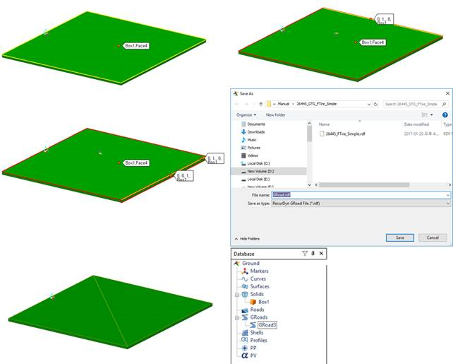
41.1.3.1. GRoad Modeling
Two methods can be used to create the GRoad. One is to directly use the .rdf file and the other is to use the .rdf file after extracting the road patch data from the geometry. Before creating the GRoad, the user must save the model because the local path of the .rdf file is saved to the GRoad and the location of the rdyn file becomes the standard. If the user clicks Import GRoad or Face GRoad without saving the model, the following error message appears.
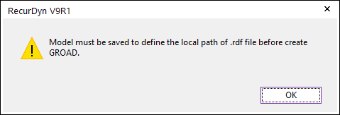
Figure 41.6 GRoad error message
41.1.3.1.1. Create Method using the .rdf file
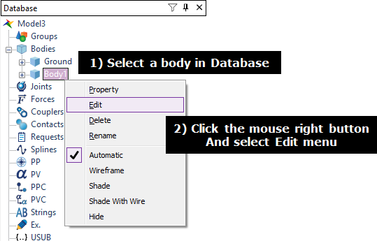
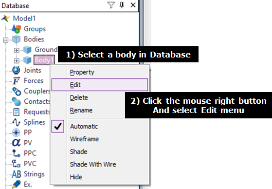
Enter the Body Edit mode.
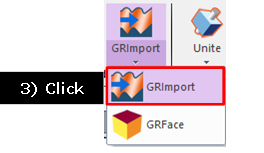
Click Import Groad.
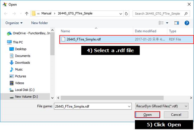
Select a .rdf file and click Open in the Open dialog box. The .rdf file exists in a folder including the rdyn file because the relative path is used to define the location of .rdf file.
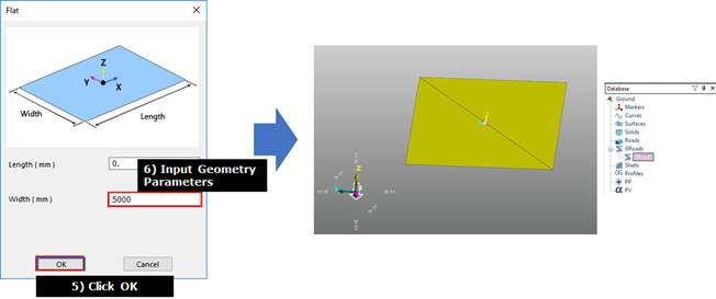
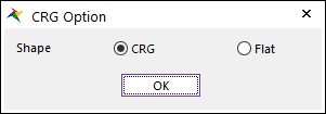
Input geometry parameters (TNO rdf file only)
Vender |
Road Type |
Method |
Road Type |
RecurDyn Geometry |
TNO (MF,SWIFT) |
CRG Road |
3D |
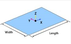
flat |
|
CRG Road |
3D |
crg |
Shape defined in file |
|
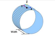
drum_road |
2D |
drum |
|
|
flat_road |
2D |
flat |
|
|
p lank_road |
2D |
plank |
|
|
poly line_road |
2D |
p oly_line |
|
|
sine_road |
2D |
sine |
|
Note
Rdf file example
MFTire: <Install Dir>\Toolkits\MFTire\Road data files
UATire: <Install Dir>\Toolkits\GTire\RECURDYN_UA\road_files
Ftire: <Install Dir>\Toolkits\GTire\COSIN_FTIRE\road_files
41.1.3.1.2. Create Method using the Geometry (UATire)
The UATire model can be used by the rdf file after extracting the road patch data from the desired geometry like as the existing UATire. This road model can be applied to the UATire model. Also, the path of the rdf file is continually saved in GUI because the rdf file of GRoad is used in the solver. If the connection is broken, the user can perform an analysis.
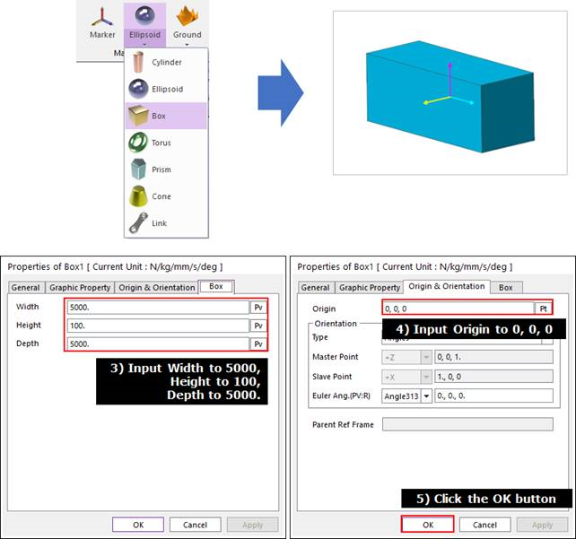
Enter the Body Edit mode.
Create a box geometry for the road modeling.
Click Face GRoad to select the creation method. The user can select several surfaces by selecting MultiFace, Direction, Direction, WithDialog option to create the GRoad.
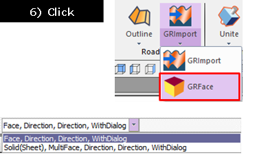
Select a face, the normal direction, the heading direction.